Beaver Creek Oil and Gas Field Research Project
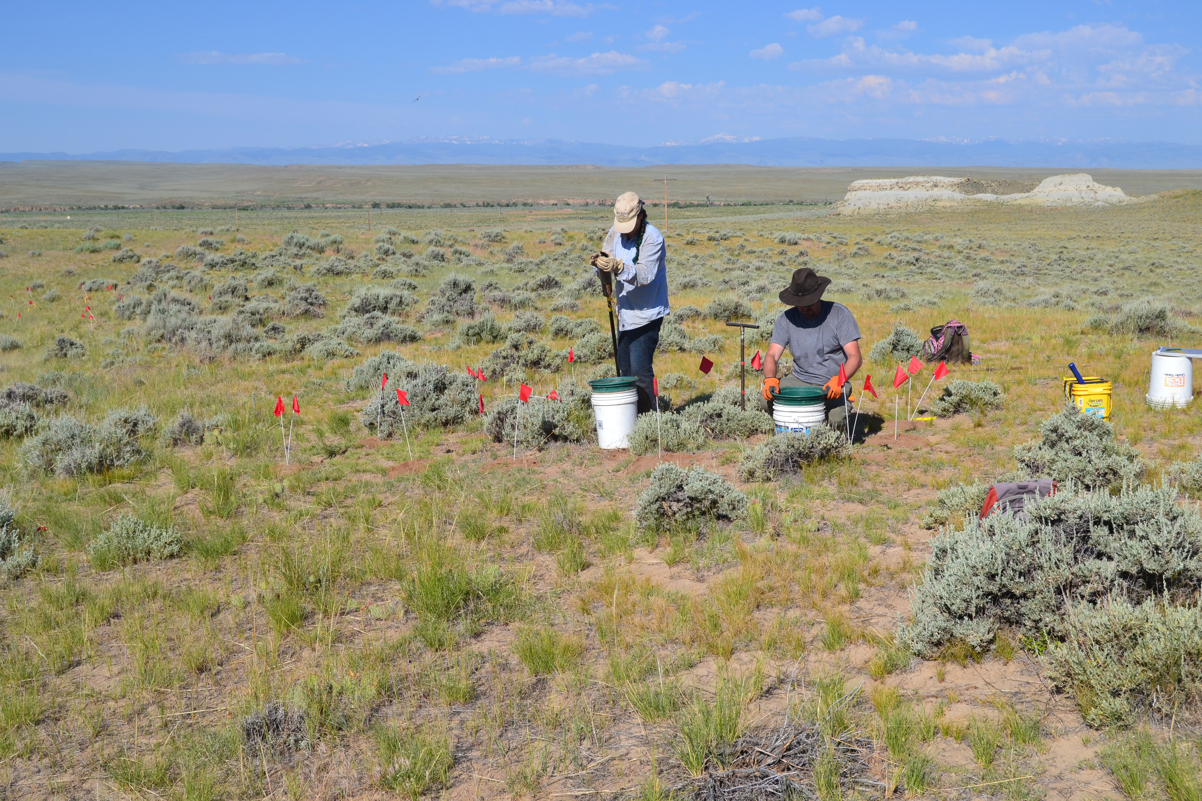
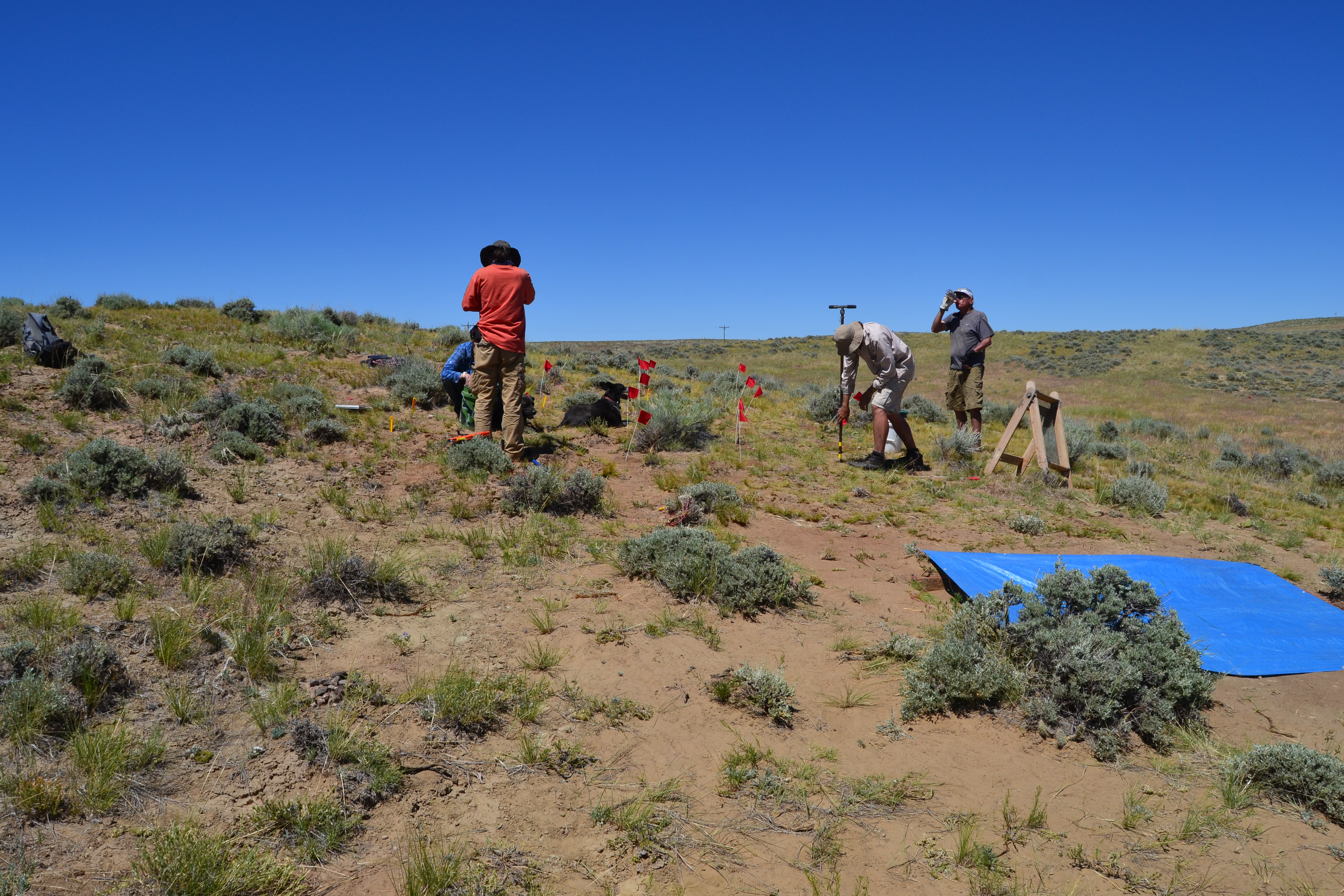
The Beaver Creek Oil and Gas Field is known for its buried prehistoric resources as well as its intensive development of oil and gas wells, pipelines, and roads. These competing resources – prehistoric sites to be protected and studied versus oil and gas resources to be extracted - have inevitably ended up in conflict. To try to facilitate both protection and development, a Programmatic Agreement (PA) was negotiated and signed in 2001. Besides setting up a research design and management plan, the PA also established a research fund. This research fund was designed to research ways for archeologists to better understand the cultural resources of the Field and to streamline the Section 106 process.
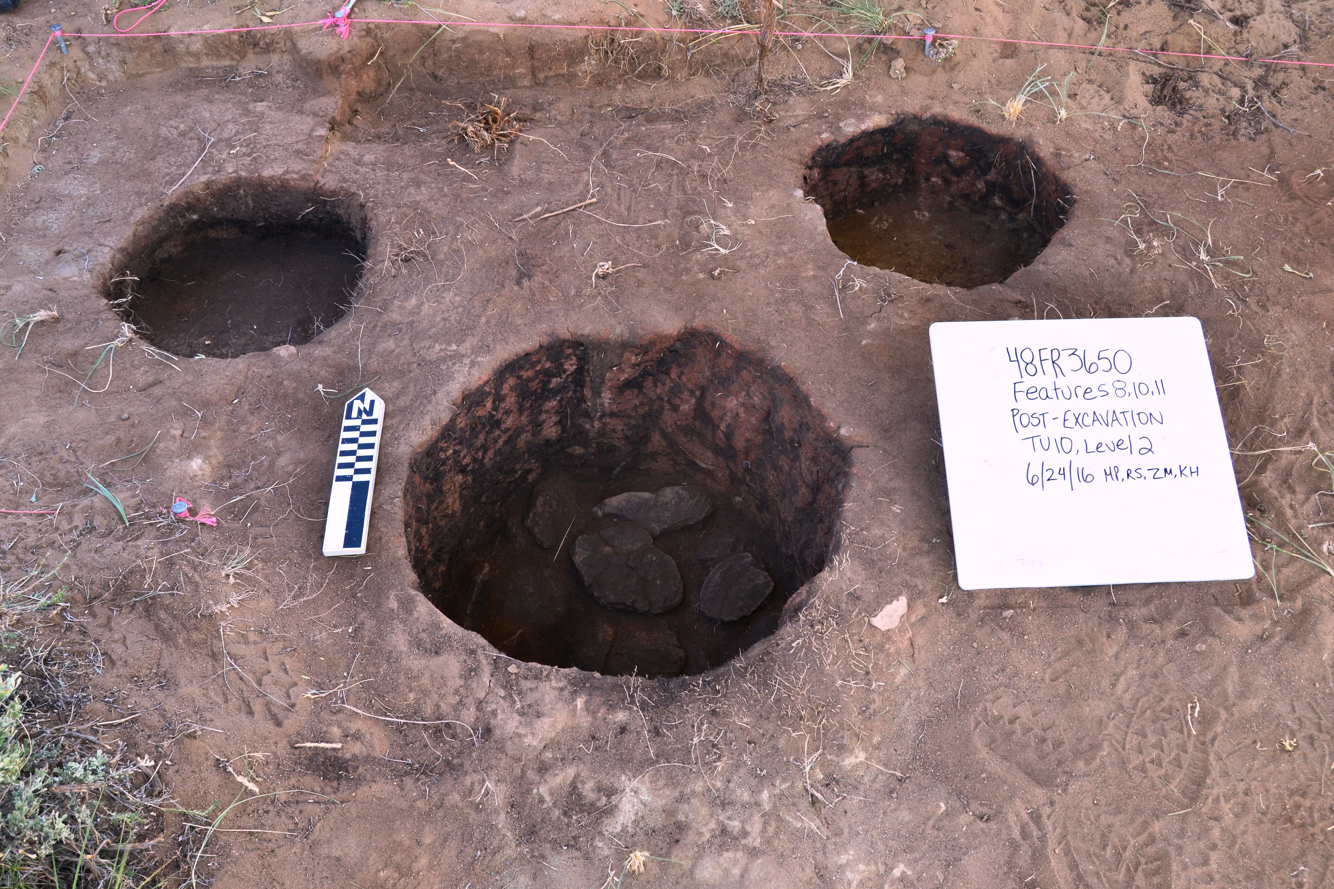
In 2016, BLM, SHPO, and OWSA developed and approved a plan to conduct remote sensing research at the Field, which is currently being implemented. The research plan is focused on the testing of various geophysical methods to identify buried prehistoric features. Magnetometer, ground penetrating radar, and ground conductivity methods are being tested to see if they can reliably identify and even differentiate known and unknown features such as roasting pits, basin hearths, and housepits. The hope is that if one or more of these methods work, then the discovery of buried features in proposed development areas would be possible without actually moving soil and damaging the features in the process. Companies and the BLM could then make better informed decisions when conflicts between cultural resources and oil and gas development arise.